The 30 Best Hiking Trails in Alabama: The State’s Most Scenic Routes

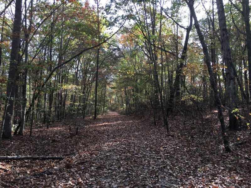
Alabama offers hikers a diverse landscape of trails that wind through mountains, forests, canyons, and state parks across the northern, central, and southern regions of the state. From the foothills of the Appalachian Mountains to pristine wilderness areas and historic sites, the state provides outdoor enthusiasts with hundreds of miles of hiking opportunities suitable for all skill levels.
These carefully selected trails showcase Alabama’s most rewarding hiking experiences, featuring waterfalls, scenic overlooks, cave systems, and unique geological formations that define the state’s natural beauty.
Whether hikers seek challenging mountain terrain, peaceful nature walks, or family-friendly adventures, Alabama’s trail system delivers memorable outdoor experiences throughout its varied ecosystems and protected lands.
Here are the 30 best hiking trails in Alabama:
1. Walls of Jericho Trail
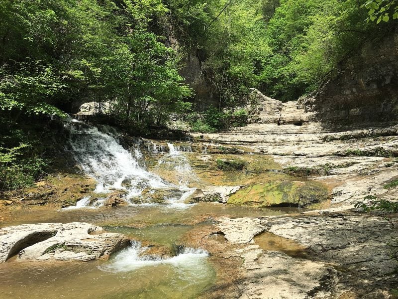
The Walls of Jericho Trail ranks among Alabama’s most challenging and rewarding hikes. This 6.6-mile out-and-back trail near Estillfork takes approximately 3 hours and 19 minutes to complete.
The trail descends into a valley, offering the unique experience of climbing out on the return journey. Hikers cross Hurricane Creek and Turkey Creek via log bridges before following Turkey Creek to the destination.
The trail leads to dramatic limestone cliffs that form natural walls around a beautiful waterfall. Water pours into an underground cavern, creating a stunning finale to the hike.
Two trailheads provide access to this destination. The Alabama trailhead offers the shorter 6.6-mile route, while the Tennessee trailhead extends the hike to 7.6 miles.
The area spans over 21,000 acres and attracts visitors for birding, camping, and hiking throughout most of the year.
2. Oak Mountain State Park Red Trail
The Red Trail stands as the longest trail in Oak Mountain State Park, forming a complete loop for hikers. This trail begins at the North Trailhead and follows a Jeep Road to reach one of the highest points in the park.
Located in Alabama’s largest state park, the Red Trail offers substantial variety along its route. The trail provides access to scenic views, historical sites, and natural landmarks throughout the journey.
Hikers can access the trail from convenient parking areas at both north and south trailheads. Additional amenities include changing rooms, water stations, and a bike wash facility near the South trailhead parking area.
The trail connects to Oak Mountain’s extensive 52-mile trail system. Park entry requires a fee, with different rates for adults, children, and seniors, though annual passes are available for frequent visitors.
3. Cheaha State Park Pinhoti Trail
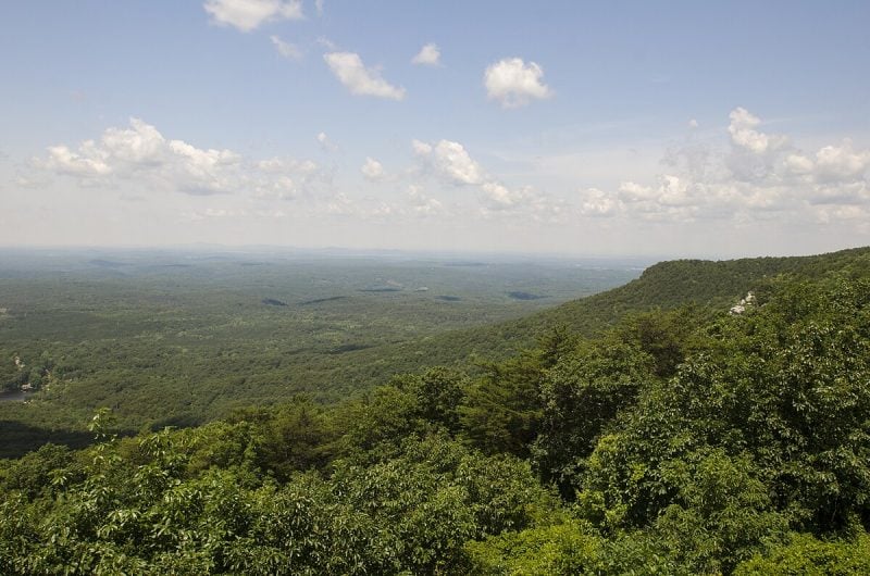
The Pinhoti Trail section through Cheaha State Park covers approximately 4 miles of the 339-mile trail system. This segment offers some of the most challenging and rewarding hiking in Alabama.
The trail passes through Alabama’s highest elevation point at Cheaha Mountain. Hikers encounter steep, rocky terrain with significant elevation changes throughout this section.
Panoramic views of the Talladega Range make this portion particularly scenic. The trail winds through dense forest areas within the 2,000-acre state park.
The Pinhoti name means “Turkey home” in the Creek language. Wildlife sightings include turkeys, various bird species, and occasionally black bears.
Most of the trail runs through Talladega National Forest. The park requires an entrance fee for access to trailheads and facilities.
This section connects to the broader Pinhoti Trail network extending into Georgia. The rocky stretches and elevation gain create a moderately difficult hiking experience suitable for experienced hikers.
4. Monte Sano State Park Loop Trail
Monte Sano State Park features the North Plateau Loop, which surrounds the inner park and serves as the main access point to five additional trails. This heavily used trail ranks as the easiest option for hikers of all skill levels.
The loop provides spectacular views of Logan Point and the northwest side of Monte Sano Mountain. Hikers can explore historic features including an abandoned lodge, CCC-built picnic areas, and the park’s amphitheater.
Located in Huntsville, Alabama, the park sits atop Monte Sano Mountain at 2,140 acres. The trail offers mountain air and scenic overlooks of the Tennessee Valley below.
The North Plateau Loop connects with other plateau trails for extended hiking opportunities. Recent rainfall creates a small waterfall near the junction with McKay Hollow Trail, adding seasonal interest to the hike.
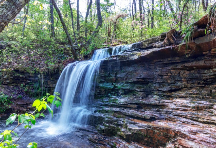
5. Sipsey Wilderness Trails
The Sipsey Wilderness encompasses Alabama’s largest federally designated wilderness area within Bankhead National Forest. This 26,000-acre wilderness offers the highest level of protection for federal lands.
Hikers can explore over 30 miles of hiking trails throughout the wilderness. The trail network features diverse terrain and multiple route options for different skill levels.
The area contains numerous waterfalls, including five major cascades along popular routes. Hikers should expect frequent creek crossings and potentially wet conditions during high water periods.
Trail navigation can be challenging due to less defined paths. GPS devices or detailed trail maps are recommended for staying on designated routes.
The wilderness was established under the Eastern Wilderness Areas Act of 1975. Group size restrictions and specific local guidelines apply to all visitors entering the protected area.
6. Little River Canyon Rim Trail

The Little River Canyon Rim Trail follows the dramatic edge of one of Alabama’s deepest canyons. This trail offers spectacular views of sandstone cliffs, waterfalls, and forested canyon walls.
Hikers can access the rim trail from various points along Canyon Rim Drive (AL 176). The trail provides multiple overlooks showcasing the canyon’s unique geology and the Little River flowing below.
The path features rocky terrain with some steep sections near overlook points. Sandstone bluffs and rock outcrops create natural viewing platforms for photography and wildlife observation.
Spring and summer months offer the best waterfall views when water levels are higher. The trail connects to other preserve trails, allowing for extended hiking opportunities through the backcountry areas.
This rim trail showcases why Little River Canyon earned national preserve status in 1992.
7. Buck’s Pocket State Park Trail

Buck’s Pocket State Park sits atop Sand Mountain in northeastern Alabama, offering hikers over 15 miles of interconnected trails. The park covers 2,000 acres of rugged terrain with dramatic vertical bluffs and clear creeks.
The Indian House Trail provides a shorter hiking option, featuring ancient rock overhangs that once sheltered Native Americans. For longer adventures, the Primitive Campground Trail leads to the lake through thick hardwood forests.
Point Rock delivers panoramic views of the surrounding valleys and peaks. The park’s picnic area sits on the canyon rim, providing natural vistas into the pocket below.
Wildlife thrives throughout the trail system, including various birds and waterfowl. The diverse ecosystem supports wildflowers and dense forest growth along the hiking paths.
8. DeSoto State Park Trails
DeSoto State Park sits atop Lookout Mountain in northeast Alabama near Fort Payne. The park features over 30 miles of hiking trails, including 11 miles designated for mountain biking.
Most trails interconnect with each other, creating flexible route options. The trail system showcases interesting rock formations and seasonal waterfalls throughout the park’s 28-mile network.
Hikers can explore diverse plant communities and sandstone glade areas. The trails wind through mixed pine and hardwood forests, offering views of the surrounding landscape.
The park allows leashed dogs on all trails. Popular routes include the Talmadge Butler Boardwalk Trail and the Family Bike loop, which passes through grassy meadows and wooded areas.
DeSoto Falls, a 107-foot waterfall, lies 5.9 miles north of the main park area. The park maintains a hiking trail that leads to the pool at the base of the falls.
9. Cathedral Caverns Nature Trail

Cathedral Caverns State Park offers approximately five and a half miles of hiking trails across 493 acres in northeast Alabama. The park features color-coded trails including blue, gray, green, and yellow routes marked with painted blazes for easy navigation.
The most popular option combines the Yellow and Green Trails, creating a 2.6-mile loop with 465 feet of elevation gain. This moderately rated trail receives positive reviews from hikers exploring the forested slopes of Mt. Pisgah.
Trail parking is available near the blue trail entrance. The hiking paths provide access to one of Alabama’s most accessible mountain forests, offering scenic views of the surrounding landscape.
Beyond the famous cave system, these trails attract trail runners and nature enthusiasts year-round. The park hosts annual running events utilizing the trail network each November.
10. Chewacla State Park Loop

The Chewacla State Park Loop spans 2.2 miles through Auburn, Alabama’s scenic landscape. This moderately challenging trail takes approximately 48 minutes to complete.
Hikers navigate through hardwood forests and follow riverside paths. The trail features 147 feet of elevation gain across varied terrain.
The loop showcases stunning geological formations throughout the route. A 30-foot waterfall at Chewacla Dam serves as a major highlight.
The park encompasses 696 acres with diverse ecosystems. Visitors encounter minimal roots and rocks on most sections.
This multi-use trail welcomes both hikers and mountain bikers. Dogs are permitted but must remain leashed at all times.
The trail operates year-round with consistent accessibility. Peak usage occurs during moderate weather seasons when conditions are most favorable.
11. Rickwood Caverns State Park Trail
The Fossil Mountain Hiking Trail stretches 1.25 miles through Rickwood Caverns State Park, located 30 miles north of Birmingham. This limestone-covered mountainside trail offers hikers the unique opportunity to search for fossils embedded in the rocks.
The trail gets its name from the leaf and seashell imprints visible throughout the rocky terrain. Wildflowers and resurrection ferns grow along the limestone outcrops, creating scenic views during the hike.
Hikers can explore both forested areas and limestone hills within the park. The peaceful trail provides a moderate challenge as it winds up the mountainside.
The park combines hiking with underground cave tours, making it an ideal destination for outdoor enthusiasts interested in geology and archaeology. An Olympic-size swimming pool fed by cave waters provides post-hike refreshment.
12. Noccalula Falls Park Trail
The Noccalula Falls Park Trail in Gadsden, Alabama offers hikers access to a stunning 90-foot waterfall. This easy trail features minimal elevation gain of 101 feet and takes approximately 30 minutes to one hour to complete.
The park maintains an extensive trail system with clearly marked paths suitable for families. Hikers can explore multiple routes designed for walking, birding, and nature observation.
The main trail leads visitors to scenic viewpoints of the waterfall and surrounding landscape. The terrain remains fairly level throughout most sections, making it accessible for beginners and experienced hikers alike.
Noccalula Falls Park features additional recreational activities beyond hiking. Visitors can explore the botanical garden, petting zoo, and historical exhibits located within the park grounds.
The trail system connects to various park amenities and camping areas. Multiple waypoints help guide hikers through the network of interconnected paths.
13. Palmer Park Trail
Palmer Park Trail connects to the Bradford Creek Greenway system in Alabama. The trail provides access to a 2.3-mile greenway that extends from Palmer Park to Heritage Elementary School.
This trail offers a straightforward hiking experience suitable for various skill levels. The path follows the Bradford Creek corridor and maintains relatively flat terrain throughout most of its length.
Hikers can enjoy a peaceful walk through natural areas while staying close to urban amenities. The trail’s location makes it accessible for both local residents and visitors exploring the region.
The connection to Bradford Creek Greenway allows for extended hiking opportunities. Trail users can experience Alabama’s natural beauty while following well-maintained pathways that accommodate both walkers and cyclists.
14. Red Mountain Park Trails
Red Mountain Park spans 1,500 acres in central Alabama, making it the largest urban park in the state. Located minutes from downtown Birmingham, the park offers convenient access to extensive trail networks.
The park features 15-16 miles of hiking and biking trails suitable for various skill levels. Many trails are wide, flat, and accessible for families and beginners.
Hikers can explore remnants of historic mining equipment from the late 1800s and early 1900s scattered throughout the park. These artifacts provide glimpses into the area’s industrial heritage.
The park includes three distinctive treehouses that serve as unique attractions along the trail system. Two scenic overlooks offer views of Birmingham and the surrounding landscape.
Trail surfaces vary from natural single-track to wider double-track paths. The network accommodates hiking, trail running, mountain biking, and birding activities.
Red Mountain Park provides picnic facilities and serves as a popular destination for both adventure seekers and families seeking outdoor recreation.
15. Tannehill Ironworks Historical State Park Trail
This trail combines outdoor recreation with Civil War history across 1,500 acres near Birmingham. The park preserves a 19th-century iron-making complex that supplied iron to Confederate forces during the Civil War.
Hikers follow well-marked trails through pine and hardwood forests with 200 feet of elevation change. The route passes historic furnace stacks, slave quarters, and a cemetery from the ironworks era.
The trail crosses Roupes Creek and features rock outcroppings throughout the woodland terrain. Visitors can explore restored buildings including a cotton gin, pioneer farm, and working gristmill.
Multiple trail options exist, ranging from technical rocky paths to smooth singletrack routes. The historic loop trail specifically circles the main ironworks buildings and furnace ruins.
Located less than 30 minutes from downtown Birmingham, the park offers convenient access to both nature and Alabama’s industrial heritage.
16. William B. Bankhead National Forest Trails
William B. Bankhead National Forest spans 181,230 acres in northwest Alabama. The forest contains over 30 miles of hiking trails suitable for all skill levels.
The Sipsey Wilderness area offers the best hiking opportunities within the forest. This designated wilderness provides diverse terrain and excellent wildlife viewing chances.
Hikers can choose from beginner-friendly paths to challenging overnight adventures. The trail system accommodates both day hikers and backpackers seeking multi-day experiences.
The forest features Alabama’s only National Wild and Scenic River, the Sipsey Fork. Six recreation areas throughout the forest provide different trail access points and facilities.
Most trails wind through dense forests with opportunities to spot local wildlife. The forest’s location near Double Springs and Houston makes it easily accessible for visitors.
17. Hurricane Creek Trail
Hurricane Creek Park offers approximately 7 miles of hiking trails nestled between Vinemont and Cullman along U.S. 31. The park features multiple trail options including a popular 3.1-mile loop that showcases the area’s natural beauty.
Hikers can explore narrow trails lined with pine trees that lead to several waterfalls and swimming holes. The terrain includes some inclines, providing a moderately challenging experience for most skill levels.
Notable features include rope swings, a swinging bridge, and unique formations like Heaven’s Staircase and Bottleneck. The Twilight Tunnel and Hidden Valley Loop presents a distinctive 1.1-mile route that takes about 34 minutes to complete.
The park provides amenities such as restrooms, picnic tables, and easy access to creek areas. Hurricane Creek remains relatively uncrowded, making it an excellent choice for both casual hikers and families seeking a peaceful outdoor experience.
18. Turkey Creek Nature Preserve Trail
Turkey Creek Nature Preserve sits on 466 acres in Pinson, Alabama, just 15 miles north of Birmingham. The preserve features five separate trails totaling 6.23 miles of hiking opportunities.
The Highland Trail offers a paved 0.38-mile route with moderate elevation changes through highland forests. This trail accommodates both hikers and cyclists.
The Boyscout Trail spans 0.35 miles along Turkey Creek’s scenic banks. This easy trail provides access to some of the preserve’s most picturesque creek views.
All trails are well-maintained and clearly marked with informational signs throughout. The preserve includes benches and picnic areas for rest stops.
The preserve operates from 8:00 AM to 4:00 PM November through March, and 8:00 AM to 5:30 PM from March through November. Entry is free for all visitors.
19. Hawthorne Trail at Oak Mountain
The Hawthorne Trail winds through Oak Mountain State Park’s diverse terrain in central Alabama. This trail showcases the park’s natural beauty within its nearly 12,000-acre landscape.
Hikers encounter oak-covered hills and peaceful woodland settings along the route. The trail connects to Oak Mountain’s extensive 50-mile trail system, allowing for longer adventures.
The path features moderate elevation changes typical of the southern Appalachian foothills. Wildlife viewing opportunities include various bird species and native animals throughout the hike.
Located just south of Birmingham, the trail provides easy access for day trips. The well-maintained path suits hikers seeking a quality outdoor experience without traveling far from urban areas.
Oak Mountain State Park’s location at the southern tip of the Appalachian Mountain chain creates unique geological features along the trail.
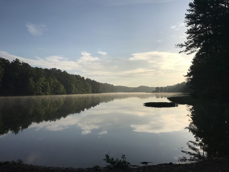
20. Lake Lurleen State Park Trails
Lake Lurleen State Park offers over 23 miles of multi-use trails in Tuscaloosa County. The 1,625-acre park sits along the shoreline of a 250-acre lake.
Most trails follow the lake’s perimeter, providing water views throughout the hike. Trail difficulty ranges from easy to moderate, making them suitable for various skill levels.
The trail system accommodates hikers, runners, and mountain bikers. Popular routes include the Ridge Loop Trail, which spans 4 miles through diverse terrain.
The park currently has limited access due to renovations. Approximately 15 miles of trails remain open, including four loop options for visitors.
Trail users can access updated maps through the TrailForks app. The park charges an entrance fee for trail access.
Beyond hiking, the park features fishing piers, picnic areas, and a nature center. The lakeside setting provides opportunities for wildlife viewing and photography.
21. Florala State Park Trail
Florala State Park offers a paved walking trail that stretches along the shores of Lake Jackson. This 40-acre park sits within the city limits of Florala, straddling the Alabama-Florida state line.
The trail provides an easy walk through the compact park grounds. Hikers can enjoy views of the 500-acre lake while following the well-maintained path.
The park features additional amenities including swimming areas, fishing spots, and picnic facilities. A modern lakeside campground accommodates overnight visitors.
Located in Covington County, the park serves as a gateway to southern Alabama. It sits less than 50 miles from Gulf Coast beaches, making it accessible for day trips.
The trail works well for families and casual hikers seeking a relaxed outdoor experience. The paved surface accommodates various fitness levels and walking preferences.
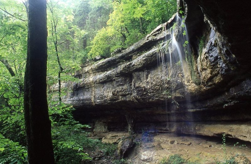
22. Dismals Canyon Trail
Dismals Canyon Trail offers a 1.5-mile loop through Alabama’s National Natural Landmark. The trail follows Dismals Branch stream through towering boulders and past waterfalls.
Hikers navigate a well-maintained path that winds along the canyon floor. The route passes through moss-covered rock formations and shaded areas.
The trail begins at Rainbow Falls near the visitor center. A wooden stairway leads down into the canyon’s heart.
Most visitors complete the hike in 2-3 hours despite its moderate length. The trail remains largely level throughout the journey.
The canyon features caves, streams, and unique geological formations. Visitors can explore this whimsical landscape during daytime self-guided tours.
The trail showcases Alabama’s diverse natural features within a compact hiking experience. Large boulders and rock formations create a distinctive hiking environment.
23. Florence Nature Preserve Trail
Florence Nature Preserve features over 5 miles of hiking trails across 600 acres on Little Pisgah Mountain’s slopes. The preserve sits off Highway 74A in Gerton, North Carolina.
Hikers encounter pristine creeks and cascades throughout the trail network. Scenic rock outcrops provide excellent viewing spots along the paths.
The Blue Trail serves as the preserve’s longest route. This narrow, slope-side trail includes creek crossings on log bridges and connects to the Yellow trail.
Old growth forest sections create diverse hiking experiences. Visitors can explore ruins of historic homesites scattered throughout the preserve.
The trail system offers multiple difficulty levels and route options. Families and experienced hikers both find suitable paths within the preserve’s boundaries.
Multiple creek crossings and elevation changes characterize the terrain. The preserve maintains well-marked trails with clear signage for navigation.
24. Cahaba River National Wildlife Refuge Trail
The Cahaba River National Wildlife Refuge features over 6.5 miles of hiking trails through Alabama’s longest free-flowing river corridor. The refuge was established in 2002 to protect this biologically diverse waterway.
The most popular route is the Piper Trail, accessed from County Road 24. This trail follows a former railroad bed and includes two scenic overlooks of the Cahaba River.
The Cahaba River Trace runs parallel to the river from Country Road 24 to the refuge’s southern boundary. Mixed pine and hardwood forests line one side while the flowing river creates the other border.
The refuge protects 131 fish species, more than any other river of comparable size in North America. Hargrove Shoals contains the largest stand of rare shoals lily, locally known as the Cahaba lily.
Hikers can expect well-maintained trails with abundant wildlife viewing opportunities and interesting rock formations along the riverbank.
25. Horn Mountain Trail
Horn Mountain Trail offers one of Alabama’s most challenging hiking experiences. The trail follows the Pinhoti Trail system and presents significant elevation gain.
Hikers face a demanding 16.2-mile out-and-back route. The trail requires 8-9 hours to complete with an elevation gain of 2,637 feet.
The difficulty rating reflects the substantial distance and steep climbs. Multiple viewpoints provide scenic rewards throughout the journey.
Wildflowers appear seasonally along the path. The trail winds through Talladega National Forest near Millerville.
The route repeatedly crosses forest service roads. Spiderwort and narcissus daffodils bloom during certain seasons.
This trail suits experienced hikers seeking a full-day adventure. The challenging terrain demands proper preparation and fitness levels.
26. Brierfield Furnace Historical State Park Trail
This 1.0-kilometer circular trail offers hikers a unique blend of history and nature in central Alabama. The moderately challenging route typically takes about 15 minutes to complete.
The trail winds through the ruins of the historic Brierfield Furnace, where Civil War-era iron production once thrived. The Confederate government operated this facility until Union forces destroyed it in March 1865.
Hikers can explore the preserved furnace ruins while walking along scenic paths through lush forests. The trail follows portions of the Little Cahaba River, providing peaceful water views.
The park spans 45 acres and features well-maintained hiking paths suitable for wildlife spotting and birding. The location serves as a stop on the West Alabama Birding Trail.
Visitors will find ample parking and picnic areas near the trailhead. The relatively short distance makes this trail accessible for most fitness levels while offering meaningful historical exploration.
27. Tuskegee National Forest Trails
Tuskegee National Forest offers three main trails for hiking enthusiasts. The forest’s compact size doesn’t limit its trail quality or scenic value.
The Bartram National Recreation Trail spans 8.5 miles and stands as the longest option. This trail honors naturalist William Bartram who explored the region in the 1770s. It’s considered the best single track trail in central Alabama.
Pleasant Hill Trail covers 4 miles one-way and serves as Alabama’s newest hiking and biking trail in the forest. The moderate-difficulty path provides excellent recreational opportunities for various skill levels.
Bold Destiny Horse Trail extends 13.4 miles and accommodates equestrian activities. The forest sits conveniently near Auburn and Tuskegee Universities, making it accessible for students and locals.
Spring and fall offer the most comfortable weather conditions for hiking these trails.
28. Limestone Park Trail
Athens-Limestone Park offers scenic hiking trails across its 132-acre property in Limestone County. The park features several well-maintained paths that wind through wooded areas and along the Elk River banks.
Hikers can explore multiple trail options suitable for different skill levels. The trails provide access to diverse natural environments within the park’s boundaries.
The wooded sections offer shade and wildlife viewing opportunities. River access points allow hikers to enjoy waterfront scenery and potential bird watching along the Elk River.
The park serves as a popular destination for outdoor recreation in north Alabama. Its trail system connects visitors with the natural beauty of the Tennessee Valley region.
Athens-Limestone Park’s trails provide a convenient hiking experience for both local residents and visitors exploring Limestone County’s outdoor attractions.
29. Wind Creek State Park Trails
Wind Creek State Park sits at the foothills of the Appalachian Mountains near Alexander City. The park offers several hiking trails that traverse diverse terrain including hardwood bottoms and pine forests.
The Alabama Reunion Trail serves as the main hiking attraction. This moderate to difficult trail spans approximately 3.8 miles and forms a scenic loop through varied landscapes.
The Campfire Trail provides another hiking option for visitors. This trail offers a different experience from the longer Alabama Reunion Trail.
The Speckled Snake Trail winds through the park’s natural areas. Hikers can also explore the Wind Creek Yellow Trail Loop and additional color-coded trail options.
The park’s location creates hilly terrain that challenges hikers. Staff members recommend taking guidance when navigating the more difficult sections of these mountain foothill trails.
30. Point Mallard Park Trail
Point Mallard Park Trail offers hikers a scenic 2.9-mile walking path through Decatur, Alabama. The well-maintained dirt trail provides mostly flat terrain suitable for various fitness levels.
The route begins at the parking area off Point Mallard Road near Wolverine Park. Hikers follow the trail around Point Mallard Golf Course while enjoying Tennessee River waterfront views for most of the journey.
The trail spans approximately 3 miles and accommodates multiple activities including hiking, jogging, and mountain biking. Visitors can experience seasonal changes throughout the year on this accessible path.
Point Mallard Park features well-marked trails with the main walking trail being the most popular option. The park’s diverse landscapes provide opportunities for nature enthusiasts to explore Alabama’s natural beauty.
Dogs are welcome on the wooded trails, making it a family-friendly destination. The trail concludes at Point Mallard Park area, which offers additional recreational facilities.
Planning Your Alabama Hiking Adventure
Alabama’s diverse terrain and climate require careful consideration of timing, preparation, and environmental responsibility. The state’s trails present unique challenges ranging from summer heat and humidity to winter ice conditions in northern regions.
Seasonal Considerations
Spring (March-May) offers the most comfortable hiking conditions across Alabama. Temperatures range from 60-80°F with moderate humidity levels. Wildflowers bloom throughout the state’s forests during this period.
Summer (June-August) brings intense heat and humidity, with temperatures often exceeding 90°F. Early morning starts become essential for safety. Thunderstorms frequently develop in late afternoons.
Fall (September-November) provides excellent hiking weather with cooler temperatures and lower humidity. Peak foliage occurs in late October through early November in northern Alabama.
Winter (December-February) offers mild conditions in southern regions but can bring ice and snow to northern trails. Temperatures range from 30-60°F depending on location.
Essential Gear and Preparation
Water and Hydration requirements increase significantly during Alabama’s humid months. Hikers should carry 1-2 liters per person for moderate trails and additional electrolyte supplements.
Navigation Tools including trail maps and GPS devices help prevent getting lost on Alabama’s extensive trail networks. Cell service remains spotty in remote areas.
Weather Protection must include rain gear year-round due to frequent afternoon thunderstorms. Lightweight, breathable clothing works best in humid conditions.
Safety Items should include a first aid kit, whistle, and headlamp. Insect repellent becomes crucial during warmer months when mosquitoes and ticks are active.
Trail Etiquette and Leave No Trace Principles
Stay on Designated Trails to prevent erosion and protect sensitive ecosystems. Alabama’s clay soils are particularly vulnerable to damage from off-trail hiking.
Pack Out All Trash including food scraps and biodegradable items. Wildlife encounters increase when human food sources are left behind.
Respect Wildlife by observing from a distance and never feeding animals. Alabama’s trails are home to black bears, venomous snakes, and various bird species.
Yield Right-of-Way appropriately on multi-use trails. Hikers should step aside for horses and mountain bikers should yield to both hikers and equestrians.
Wildlife, Scenery, and Natural Wonders
Alabama’s hiking trails showcase remarkable biodiversity with over 4,000 plant species and diverse wildlife populations. The state’s unique geological formations include limestone caves, sandstone canyons, and ancient mountain ridges that create stunning backdrops for outdoor adventures.
Notable Flora and Fauna
Alabama ranks among the most biodiverse states in the nation. The state hosts over 62 mammal species, including black bears in the northern mountains and white-tailed deer throughout forested areas.
Mountain Wildlife includes wild turkeys, bobcats, and red-tailed hawks. Black bears populate the Bankhead National Forest and surrounding wilderness areas. Hikers often spot gray foxes and raccoons along evening trails.
Wetland Species thrive near rivers and lakes. Great blue herons wade through shallow waters while beavers build dams along slower streams. Painted turtles and various snake species inhabit these aquatic environments.
The plant diversity changes dramatically by region. Mountain laurel and rhododendrons bloom in northern forests during spring months. Southern magnolias and live oaks dominate coastal plain trails.
Endemic species include the Alabama cavefish and several rare wildflower varieties. The state flower, the camellia, grows naturally in southeastern regions alongside native azaleas.
Unique Geological Features
Alabama’s landscape features formations spanning 500 million years. The Appalachian Mountains create the state’s highest elevations, with Cheaha Mountain reaching 2,413 feet above sea level.
Limestone caves dot the Tennessee Valley region. These underground systems formed through millions of years of water erosion. Many caves connect to create extensive underground networks.
Little River Canyon cuts through sandstone layers to form dramatic gorges. The canyon walls expose rock formations dating back 300 million years. Waterfalls cascade over these ancient stone ledges.
Natural bridges appear throughout northern Alabama. These stone arches formed when softer rock eroded beneath harder capstone layers. The most famous spans reach over 100 feet in length.
Sipsey Wilderness contains slot canyons and boulder fields. Water carved these narrow passages through sandstone over thousands of years. Rock formations create natural shelters and viewing platforms.
Best Times for Scenic Views
Spring months (March-May) offer peak wildflower displays. Dogwoods and redbuds bloom throughout forests while waterfalls run at maximum flow from seasonal rains.
Fall season (October-November) provides spectacular foliage. Maple, oak, and hickory trees create vibrant color displays across mountain ridges. Temperatures remain comfortable for extended hiking.
Winter viewing (December-February) reveals geological features hidden by summer vegetation. Bare trees expose rock formations and distant mountain views. Ice formations create temporary natural sculptures near waterfalls.
Early morning hours produce the best lighting conditions. Mist rises from valleys while sunlight filters through forest canopies. Wildlife activity peaks during these cooler temperatures.
Late afternoon offers dramatic shadows across canyon walls and rock faces. Golden hour lighting enhances the natural colors of stone formations and autumn leaves.


